




রূপান্তরকারী ভূদৃশ্য: কুশ টেপা খাল এবং উত্তর আফগানিস্তানের বাস্তুতন্ত্র
- অ্যাডমিন
- মার্চ 6, 2025
রূপান্তরকারী ভূদৃশ্য: কুশ টেপা খাল এবং উত্তর আফগানিস্তানের বাস্তুতন্ত্র
Existing Ecosystems and Regional Landscape
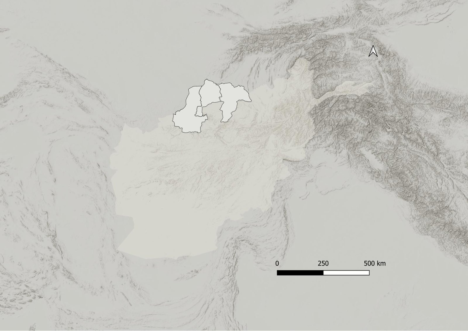
উত্তরাঞ্চলীয় আফগানিস্তান is a land of contrasts. From vast deserts and fertile deltas to mountain-fed rivers and scattered wetlands, the region is undergoing significant changes. The Regional Landscape study assesses the impact of the Qush Tepa Canal on Mazar-e-Sharif, Andkhoi, and Sheberghan by examining the interplay between various ecosystems that shape the region. This analysis considers both internal and external forces that have defined the landscape over time.
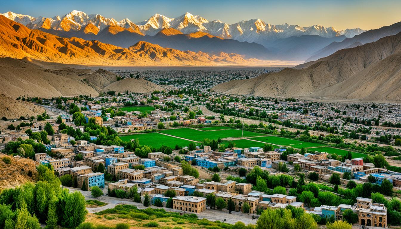
Situated on a vast deltaic plain at the confluence of the Band-e-Amir River, these northern cities are deeply linked to their environment. The flow of the Balkh, Khulam, Sar-e-Pul, and Shereen Tagab rivers creates a natural border: fertile soils with rainfed or irrigated agriculture lie to the north, while barren drylands stretch to the south. The region’s cold steppe climate—with scorching summers averaging 39°C in July and chilly winters averaging -2.1°C in January—receives minimal rainfall, reinforcing the cities’ heavy reliance on both surface and groundwater resources.
The urban fabric of Mazar-e-Sharif, Andkhoi, and Sheberghan is defined by two dominant landscape types. To the north, an extensive desert corridor marked by sand dunes parallels the Amu Darya River, contributing salt and dust that adversely affect public health. Conversely, the southern edge is graced by the Hindu Kush Mountain range, which not only supplies vital water resources but also offers a cool retreat during the intense summer heat. This natural contrast is further enriched by a variety of significant cultural landmarks located within a two-hour drive, providing sufficient opportunities for leisure and recreation. The dynamic interaction between these contrasting landscapes highlights the region’s social and economic vitality.
প্রধান প্রাকৃতিক বৈশিষ্ট্য এবং তাদের গতিশীলতা
আমো নদী:
Forming a natural boundary with Afghanistan’s northern neighbors, the Amo River is one of the largest untouched ecosystems along the border. Often referred to as the “Nile of Central Asia,” it supports diverse fish species, draws recreational enthusiasts from across the country, and serves as an important economic resource for local communities. Aral Lake, once the world’s second-largest lake, has largely dried up due to the diversion of Amu River water for irrigation. This event is considered one of the most catastrophic environmental disasters in history.
The Desert Ecosystem:
Positioned between the Amu River and Afghanistan’s northern rangelands, the desert stretches from Jawzjan to Takhar provinces in parallel with the river. Characterized by arid and semi-arid conditions, the Sand Dome Desert is a major source of seasonal sand, dust storms, and strong winds that pose significant environmental and public health risks—risks that have intensified over the past two decades due to climate change. Despite generating 35% of the Amu River’s water, Afghanistan has yet to harness it for irrigation. The Qush Tepa Canal is set to change that by becoming the country’s first project to use Amu River water for agriculture, although নকশা এই চ্যালেঞ্জগুলির ফলে প্রাথমিক ৪০ কিলোমিটারে ২২% পর্যন্ত জল হ্রাস পেতে পারে এবং জলস্তর বৃদ্ধির সাথে সাথে মাটি লবণাক্ত হওয়ার সম্ভাবনা রয়েছে। অধিকন্তু, খালটি নিজেই মরুভূমিকে বিভক্ত করে, উপলব্ধ আবাসস্থল হ্রাস করে এবং প্রজাতির চলাচল সীমিত করে।
পাহাড়-প্রধান নদী এবং কৃষি সীমানা:
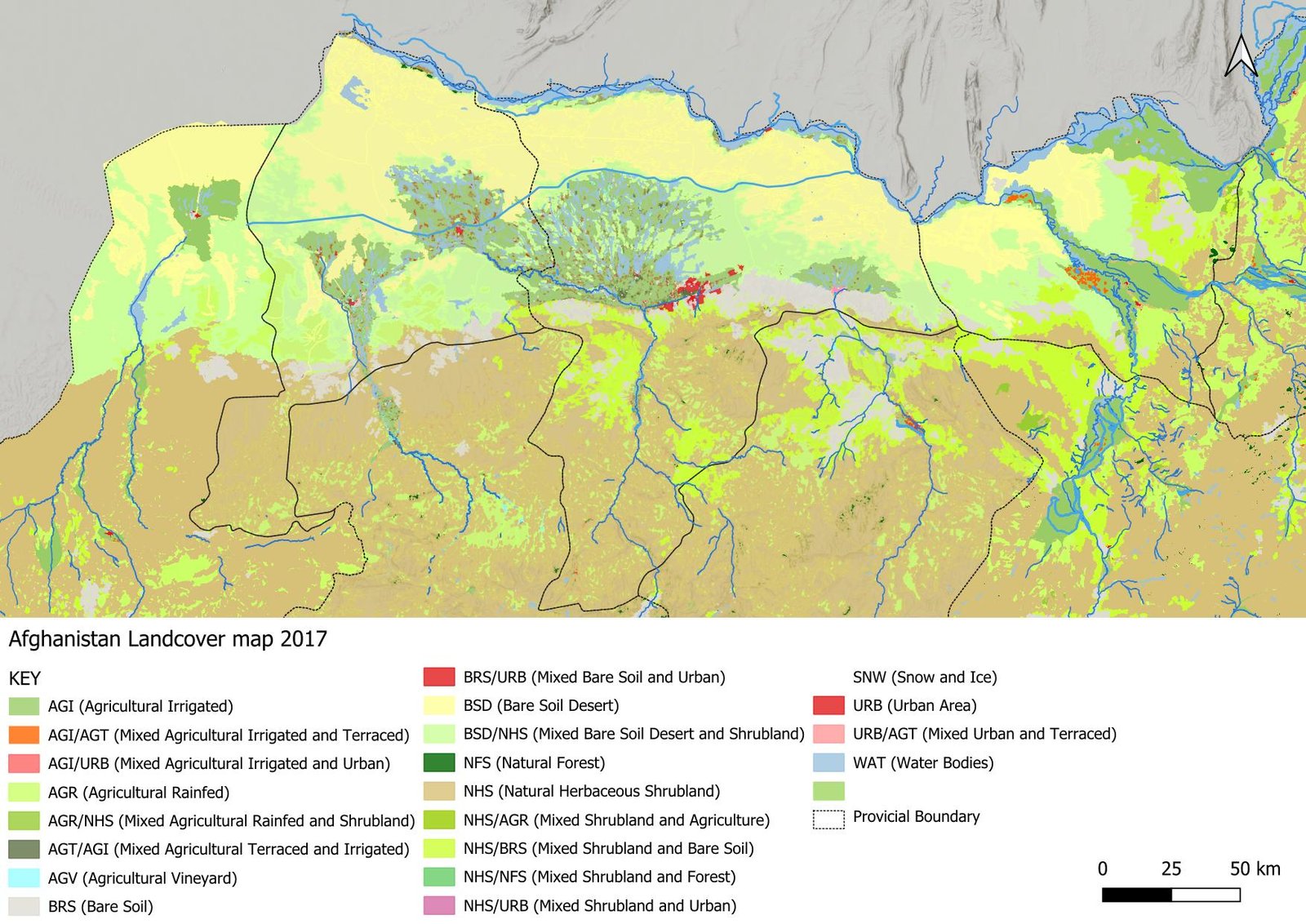
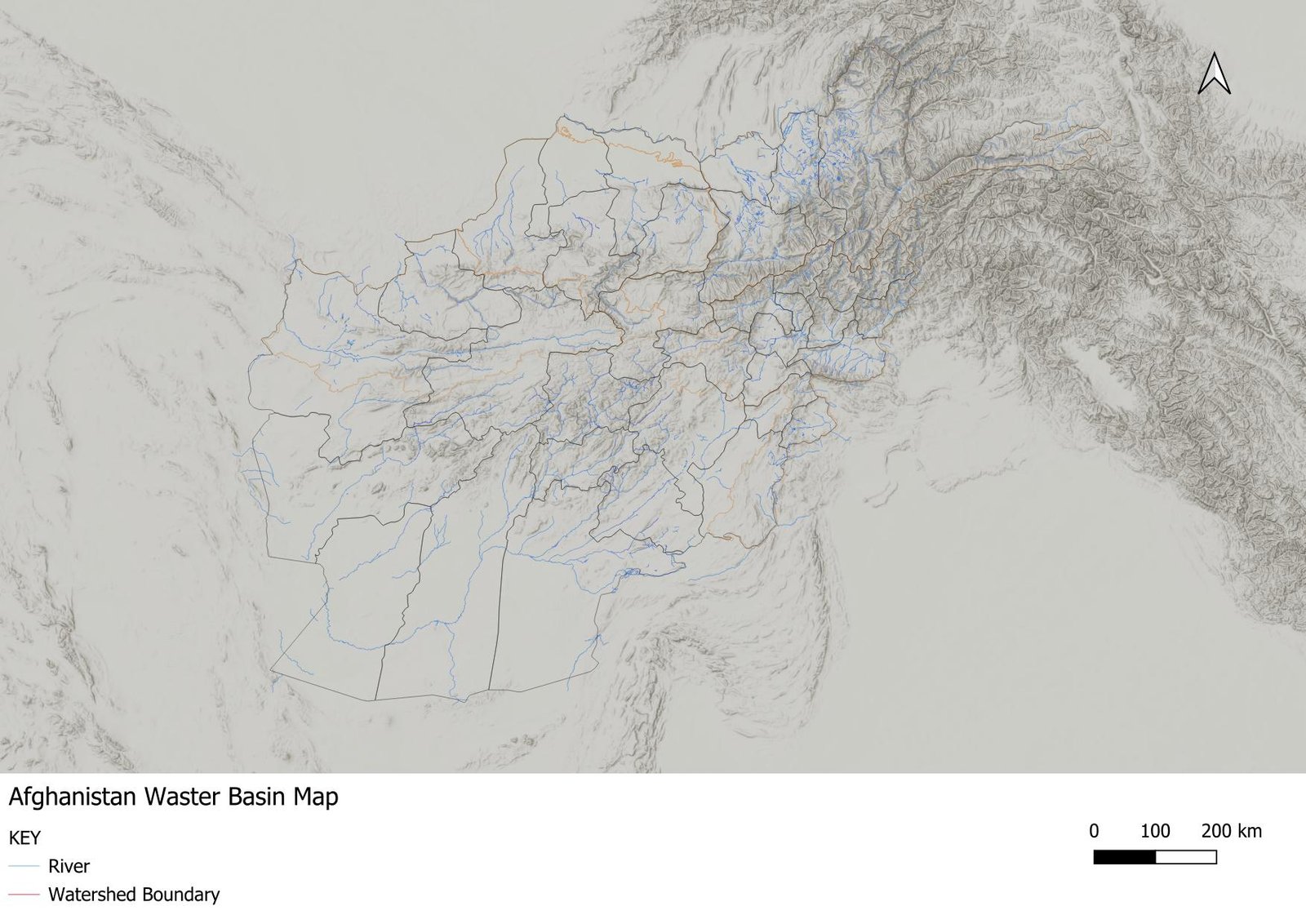
Originating from the peaks of the Hindu Kush, Alborz, and Marmal mountains, the Khulam, Balkh, Sari Pul, and Sheren Tagab rivers flow through verdant valleys before merging with the rangelands and semi-desert. Historically, these rivers reached the Amu River prior to the advent of modern irrigation systems and now delineate the boundary between fertile agricultural lands and encroaching desert. Ancient sites along the lower reaches of the Balkh River highlight early civilizations that thrived on these watercourses, once surrounded by lush grasslands now increasingly overtaken by sand dunes—a stark reminder of ongoing desertification. Satellite imagery even reveals these rivers as tree-like roots traversing the landscape, connecting agricultural lands and recreational areas within a two-hour drive from Mazar-e-Sharif.
কৃষি ভূদৃশ্য এবং প্রাকৃতিক বাধা:
Each river watershed has developed its own distinct agricultural landscape. However, natural features such as rangelands and sand dunes create barriers between these zones, rendering the habitats fragile and vulnerable to environmental stresses like extreme heat and draught. Although much of the land between irrigated fields remains moderately suitable for cultivation, rainfed agricultural zones—especially those at the end of irrigation canals—are prone to water shortages during droughts and contribute to airborne fine particles during windy seasons, further impacting air quality.
বহুমুখী ব্যবস্থা হিসেবে জলাভূমি:
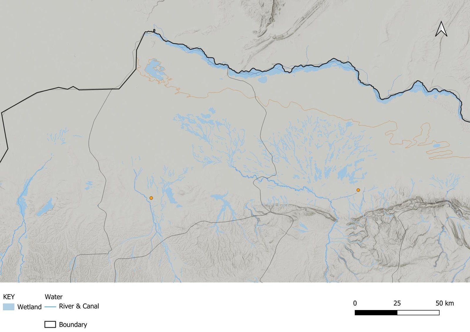
Maps of the region reveal scattered wetlands interspersed throughout expansive agricultural areas. These wetlands typically form in depressions or low-lying areas where the water table is shallow or where excess water accumulates along irrigation canals and runoff paths. Functioning as Nature-Based Solutions (NBS) for water management, these wetlands enhance flood resilience, shorten the duration of droughts, and filter out pollutants. Even in intensively cultivated zones, these natural water bodies persist as vital elements of a complex mosaic that includes irrigated fields, rainfed farms, shrublands, and deserts—each reflecting the critical influence of water availability on settlement, agriculture, and ecosystem dynamics.
জলবায়ু পরিবর্তন এবং পরিবেশগত বিপদের হুমকি
Climate change, coupled with rapid urbanization and shifts in land use, poses increasing risks to these unique ecosystems. Since 1980, natural hazards in Afghanistan have affected approximately 9 million people and claimed over 20,000 lives. Flooding remains the most common hazard, with average annual damages of $54 million and major events surpassing $500 million in losses. Although earthquakes have been less frequent, they have been deadlier—causing over 10,000 fatalities since 1980 and annual damages estimated at $80 million. Droughts have impacted 6.5 million people since 2000 during significant events in 2000, 2006, 2008, and 2011. Additionally, millions face landslide and avalanche risks, with around 10,000 km of roads (15% of the total) exposed to avalanche hazards, including critical routes like the Salan Pass.
এই প্রেক্ষাপটে, মাজার-ই-শরীফ মাঝারিভাবে খরার ঝুঁকিতে রয়েছে এবং ভূমিকম্পের জন্য অত্যন্ত ঝুঁকিপূর্ণ, এর দক্ষিণাঞ্চলীয় উচ্চ-ঢাল এবং পশ্চিমাঞ্চলীয় জলাভূমি অঞ্চলে স্থানীয় বন্যার ঝুঁকি রয়েছে। এদিকে, শেবেরঘান উচ্চ খরা এবং ভূমিকম্পের ঝুঁকির মুখোমুখি, যদিও বন্যার ঝুঁকি কম, এবং আন্দখোই মাঝারি ভূমিকম্পের ঝুঁকির সাথে উল্লেখযোগ্য খরার ঝুঁকির সম্মুখীন।
কুশ টেপা খাল: চ্যালেঞ্জ এবং সুযোগ
Afghanistan’s interim authorities project that the 287-kilometer-long Qush Tepa Canal—with a depth of 8.5 meters and an average width of 100 meters—will irrigate over 1.2 million acres of farmland and generate roughly 200,000 jobs, thereby enhancing agricultural productivity and national food security. Construction is advancing rapidly, employing about 5,000 workers and 4,000 pieces of heavy equipment. With the first phase completed and 81% of the second phase’s excavation finished, the main canal structure is expected to be completed in six years, though the full network of secondary channels may take up to 15 years.
এই আশাব্যঞ্জক সম্ভাবনা থাকা সত্ত্বেও, উদ্বেগগুলি রয়ে গেছে: নকশার ত্রুটি এবং কংক্রিটের আস্তরণের অনুপস্থিতির কারণে প্রাথমিক ৪০ কিলোমিটারে ২২% পর্যন্ত জলের ক্ষতি হওয়ার আশঙ্কা রয়েছে এবং জলস্তরের উচ্চতা বৃদ্ধির ফলে সেচ-প্ররোচিত মাটি লবণাক্ত হতে পারে।
১৯৭০-এর দশকে মূলত ধারণা করা হলেও, ১৯৭৯ সালের সোভিয়েত আগ্রাসনের পর কয়েক দশক ধরে চলা সংঘাতের কারণে প্রকল্পটি স্থগিত হয়ে যায়। ২০১৮ সালে ইউএসএআইডি কর্তৃক একটি সম্ভাব্যতা সমীক্ষা এবং পরবর্তীকালে (২০২১ সালে পতনের আগে) ঘানি সরকারের দ্বারা চালু হওয়ার ফলে ২০২২ সালের মার্চ মাসে তালেবানরা একটি প্রধান উদ্যোগ হিসেবে প্রকল্পটি পুনরায় চালু করতে পারে। পানির ঘাটতি মোকাবেলার পাশাপাশি, খালটি বলখ, সার-ই-পুল এবং শেরেন তাগাব নদীর উপর চাপ কমানোর লক্ষ্য রাখে, যার ফলে উজানের সম্প্রদায়ের জন্য বছরব্যাপী পানির প্রাপ্যতা নিশ্চিত করা যায়। এছাড়াও, এটি বনায়ন, সম্প্রসারিত সেচ নেটওয়ার্ক এবং উন্নত জলাভূমি ব্যবস্থাপনায় সরকারি উদ্যোগকে উৎসাহিত করবে বলে আশা করা হচ্ছে, যা আঞ্চলিক স্থিতিস্থাপকতা বৃদ্ধি এবং সমন্বিত, ভূদৃশ্য-ভিত্তিক সমাধানের ভিত্তি স্থাপন করবে বলে আশা করা হচ্ছে। জীব বৈচিত্র্য.
উন্নত আঞ্চলিক বাস্তুতন্ত্রের জন্য ভূদৃশ্য-ভিত্তিক সুপারিশ
As urban areas expand, improving natural resource management becomes crucial to mitigating environmental risks. Nature-Based Solutions (NBS) offer a cost-effective strategy deeply embedded in Afghan cultural practices to tackle challenges such as water security, pollution, environmental hazards, food insecurity, public health, and climate change. By harnessing natural processes, NBS aims to enhance both regional and urban resilience.
মাজার-ই-শরিফ, শেবেরঘান এবং আন্দখোই অঞ্চলে, দক্ষিণ পাহাড় এবং হিন্দুকুশ পর্বতমালা থেকে উৎপন্ন নদী এবং স্রোত দ্বারা বাস্তুতন্ত্র গভীরভাবে গঠিত। এই জলধারাগুলি প্রতিটি প্রদেশের জলাশয়ের মধ্যে কৃষি ব-দ্বীপ তৈরি করেছে এবং উত্তরে লবণাক্ত মরুভূমি তৈরিতে অবদান রেখেছে। যেখানে বালখ এবং প্লাবন নদী পাহাড়ি গিরিখাত থেকে বেরিয়ে বালখ সমভূমিতে প্রবাহিত হয়, সেই সন্ধিক্ষণগুলিতে বিশেষ মনোযোগ দেওয়া প্রয়োজন। এই অঞ্চলগুলি, যা নগর কেন্দ্র এবং কৃষি জমি উভয়কেই জল সরবরাহ করে, অনুপ্রবেশ জলাধার তৈরির সুযোগ তৈরি করে - এমন কাঠামো যা উচ্চ বৃষ্টিপাতের সময় অতিরিক্ত জল ধরে রাখে এবং পৌরসভার ব্যবহারের জন্য জলাধারে সংরক্ষণ করে।
Moreover, integrating NBS with current wastewater treatment systems could lead to the development of city-wide treatment wetlands and regional parks in the saline desert north of these cities. Such wetlands would function as biofilters, using natural chemical processes and microorganisms to break down organic materials and remove pollutants. The resulting clean water could then infiltrate shallow aquifers or be used for irrigation.
উত্তর মরুভূমির ধুলোর সাথে সম্পর্কিত স্বাস্থ্য ঝুঁকি মোকাবেলায়, জলাভূমি থেকে উদ্বৃত্ত জল ব্যবহার করে একটি সবুজ বেষ্টনী স্থাপন করলে নগরীর বায়ুর মান উন্নত হতে পারে। এই স্বল্প ব্যয়ের কিন্তু উচ্চাভিলাষী প্রকল্পগুলি সফলভাবে বাস্তবায়নের জন্য শিক্ষা এবং সক্ষমতা বৃদ্ধির উদ্যোগের পাশাপাশি পৌর বিনিয়োগের প্রয়োজন হবে।
মূল সুপারিশ:
- আন্তঃসংযুক্ত কৃষি নেটওয়ার্ক: Develop a continuous agricultural landscape to enhance resilience, reduce local temperatures, and provide uninterrupted habitats for wildlife.
- বালির টিলা বাধা: মরুভূমির দখল কমাতে কৃষিজমি এবং স্থানান্তরিত বালির টিলার মধ্যে বাধা অঞ্চল স্থাপন করুন।
- গ্রিনবেল্ট উন্নয়ন: Protect vulnerable rolling hills from overgrazing by converting them into greenbelts through the planting of local trees and shrubs, thereby preventing soil erosion, improving air quality, and offering recreational spaces.
- বাসস্থান সংযোগ: প্রজাতির চলাচল এবং অঞ্চল সংরক্ষণের জন্য খাল-বিভক্ত মরুভূমির ভূদৃশ্য জুড়ে বন্যপ্রাণী করিডোর তৈরি করুন।
- Water Management Infrastructure: উজানের পানি ব্যবস্থাপনা, জলাধার পুনর্ব্যবহার এবং খরার চাপ কমাতে এই অঞ্চলের দক্ষিণাঞ্চলে কৃত্রিম বাঁধ নির্মাণ এবং জলাভূমি উন্নয়ন করা।
- Wetland Conservation and Reforestation: বিদ্যমান জলাভূমি রক্ষা করুন এবং লবণাক্ত ও খরা-প্রতিরোধী প্রজাতির সাহায্যে উপযুক্ত এলাকাগুলিকে আন্তঃসংযুক্ত বনাঞ্চলে রূপান্তর করুন। এই উদ্যোগটি জলবায়ু পরিবর্তনের প্রভাব হ্রাস করার সাথে সাথে বায়ু, জল এবং মাটির গুণমান উন্নত করবে। যেখানে কুশ টেপা খালের জল প্রচুর পরিমাণে পাওয়া যায়, সেখানে কিছু জলাভূমি কৃষি ব্যবহারের জন্য পুনর্ব্যবহার করা যেতে পারে।
By implementing these landscape-based solutions, the region can achieve enhanced ecological resilience, improved biodiversity, and sustainable habitat conditions—thereby securing a better quality of life for its residents amid the challenges posed by climate change and rapid urbanization.
এই পোস্টটি রূপান্তরকারী ভূদৃশ্য: কুশ টেপা খাল এবং উত্তর আফগানিস্তানের বাস্তুতন্ত্র প্রথম প্রকাশিত হয়েছিল এবং লিখেছেন [ইমেল সুরক্ষিত]